
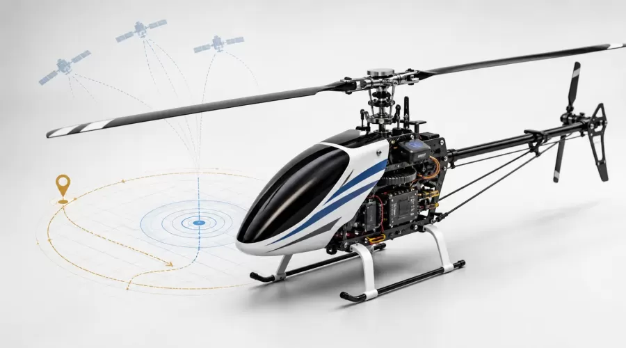
Quick answer: GPS stabilization can help an RC helicopter maintain a geographic position, but it does not make the aircraft autonomous, obstacle-aware, or immune to wind and signal loss. A reliable position-hold system combines GNSS data with the inertial measurement unit, barometer, compass, and flight-control software. Return-to-home (RTH or RTL) is a programmed recovery sequence whose behavior depends on the model, its home-point logic, sensor health, altitude settings, and the space available. Treat both functions as aids that must be tested in an open area—not as substitutes for piloting skill or a preflight inspection.
This guide explains what “stable” means in an RC helicopter, how GPS position hold differs from optical flow and altitude hold, what return-to-home can and cannot do, and how to test these functions before relying on them. The goal is a repeatable decision process for choosing and operating a scale RC helicopter, not a promise that every GPS-equipped model behaves the same way.
What “stability” actually means
Product pages often use “stable” as a single adjective, but a pilot experiences several different control layers. Separating them prevents the most common buying mistake: assuming that any stabilization feature will keep the helicopter fixed over one point outdoors.
| Control aid | What it tries to hold | Typical sensors | What it does not guarantee |
|---|---|---|---|
| Attitude stabilization | Level or commanded pitch/roll attitude | Gyroscopes and accelerometers | A fixed place over the ground |
| Heading hold | Yaw direction | Gyroscope; sometimes compass assistance | Position or altitude |
| Altitude hold | Approximate vertical height or pressure altitude | Barometer, range sensor, or both | Horizontal position |
| Optical-flow hold | Relative motion over visible ground texture | Downward camera plus range estimate | Reliable operation over every surface, height, or lighting condition |
| GPS/GNSS position hold | Latitude/longitude target, normally fused with other sensors | GNSS receiver, IMU, compass, barometer | Centimeter precision, obstacle avoidance, or operation without a good sky view |
Attitude stabilization is the foundation. It damps unwanted rotation and helps the aircraft follow the pilot’s commands, yet wind can still carry the helicopter sideways. Altitude hold controls only the vertical axis. Position hold adds a geographic reference, so the controller can command corrective pitch and roll when the estimated location moves away from the target.
The important phrase is estimated location. GPS.gov explains that real-world user accuracy depends on satellite geometry, signal blockage, atmospheric effects, multipath reflections, and receiver design—not only the satellite signal itself. Buildings, trees, bridges, and indoor use can degrade the result. That is why a scale helicopter that holds well in an open field may wander or reject GPS mode beside a structure.
How GPS position hold works
A flight controller cannot use GPS coordinates alone to keep a helicopter still. Satellite fixes arrive too slowly and contain too much short-term variation to replace the fast attitude loop. Instead, the controller blends several measurements:
- The IMU measures angular rate and acceleration many times per second. It supports the fast stabilization loop but accumulates drift when used alone.
- The GNSS receiver supplies an absolute geographic reference. It corrects long-term drift but is affected by sky visibility and signal quality.
- The barometer or range sensor estimates height. Pressure changes, rotor wash, surfaces, and sensor range can influence it.
- The compass provides a heading reference. Nearby steel, magnets, wiring, current-carrying power leads, and poor calibration can disturb it.
- The control software combines those estimates and turns position error into attitude and power commands.
Open autopilot documentation provides a useful reference architecture. ArduPilot describes Loiter mode as using GPS position, an acceptable compass, and an acceptable GPS lock to maintain location and heading while allowing pilot repositioning. This does not mean a retail helicopter uses ArduPilot, nor that it has identical limits. It shows why “GPS included” is not a complete specification: tuning, sensor placement, estimator design, and manufacturer safeguards matter as much as the receiver.
Why drift and sudden corrections happen
Small movement is normal because the controller is balancing imperfect measurements against wind and rotor dynamics. Larger or erratic movement deserves investigation. Common causes include:
- taking off before the home point and satellite status are confirmed;
- multipath near walls, vehicles, roofs, or metal structures;
- compass interference or calibration performed near metal;
- strong, gusty wind exceeding the model’s available control authority;
- vibration affecting the inertial sensors;
- switching modes before reaching a safe height and stable hover;
- mistaking optical-flow or altitude hold for GPS position hold.
Do not “tune through” unexplained movement by repeatedly taking off in a confined space. Land, power down, move to a clear site, inspect the rotor system, review the manual’s status indications, and repeat the preflight sequence.
GPS vs optical flow: complementary, not interchangeable
Optical flow estimates motion by comparing images of the ground. PX4’s technical documentation notes that usable optical flow depends on sufficient texture and lighting and is commonly paired with a downward distance measurement. A glossy floor, uniform carpet, moving grass, darkness, excessive height, or a surface outside the sensor’s range can reduce performance.
| Question | GPS/GNSS hold | Optical-flow hold |
|---|---|---|
| Primary reference | Satellite-derived geographic position | Relative image movement over the ground |
| Best environment | Open outdoor area with clear sky view | Lower altitude with good light and textured ground |
| Typical weak conditions | Indoors, under cover, beside tall objects, RF interference | Darkness, low-texture or reflective surfaces, excessive height |
| Can establish a geographic home point? | Potentially, if implemented by the manufacturer | No—not by optical flow alone |
| Obstacle avoidance? | No, unless a separate obstacle-sensing system is specified | No |
A model may combine both. For example, optical flow can support a steady low hover while GNSS provides an outdoor position reference. The handover logic is product-specific. Check the manual for mode indicators, minimum height, maximum sensor range, and what happens when one source becomes unreliable.
For shoppers comparing a GPS-equipped scale model with an optical-flow model, start with the intended flying site. The FLYWING EC135 470-Class GPS RC Helicopter and WOLFBUSH & ROBAN AH-1W Cobra 470 GPS RC Helicopter belong in an outdoor GPS-oriented comparison. The WL K270 UH-60L Optical-Flow RC Helicopter represents a different sensing approach. Compare the documented flight modes and environment limits rather than treating all three as equivalent “self-leveling” products.
What return-to-home really does
Return-to-home is not a single universal maneuver. A typical sequence may climb or descend to a configured altitude, turn or navigate toward the recorded home position, then hover or land. The exact order, trigger conditions, pilot override behavior, and landing logic vary by controller.
ArduPilot’s RTL documentation is a useful general reference: the aircraft returns toward its home position and behavior depends on configured altitude and landing parameters. Again, this is not a claim that a particular EnginesDIY product runs ArduPilot. It illustrates the questions every owner should answer from the specific model’s manual.
Five questions to answer before testing RTH
- When is home recorded? At power-on, after a valid GNSS fix, at arming, or at takeoff?
- What altitude will it use? A low return path can intersect trees; an unnecessarily high one can expose a light model to stronger wind.
- What triggers it? A switch, signal-loss failsafe, low battery, geofence, or more than one condition?
- Can the pilot cancel or steer? The manual should define how control is regained and whether cancellation is allowed during each phase.
- What happens near home? Hover, descend, or land—and at what rate?
RTH is not obstacle avoidance. Unless the product explicitly contains and documents obstacle sensors, the controller may fly a geometrically valid path directly toward a tree, building, cable, or person. It also cannot compensate for an incorrectly recorded home point, poor compass data, inadequate battery reserve, or wind stronger than the aircraft can overcome.
A practical preflight and first-flight protocol
Use the model’s own manual as the controlling document. The following sequence is a conservative framework adapted from common rotorcraft practice and the ArduPilot preflight checklist. It is not a replacement for manufacturer instructions.
1. Site and regulatory check
- Choose a large open field, away from people, roads, wires, buildings, vehicles, and animals.
- Check local airspace and operating rules. In the United States, recreational flyers should review the FAA’s recreational UAS requirements and use an approved airspace-awareness service before flying.
- Confirm wind conditions are within the aircraft manufacturer’s limit and your experience level.
2. Mechanical inspection
- Remove power before touching the rotor system.
- Inspect main and tail blades for cracks, deformation, looseness, and matching installation.
- Check linkages, landing gear, canopy, fasteners, motor mount, gears, and accessible wiring.
- Verify moving parts travel freely and nothing can contact the rotating assembly.
3. Battery and power check
- Use only the specified battery type, voltage, connector, and charger.
- Do not use swollen, punctured, overheated, wet, or damaged packs.
- Transport spare lithium batteries with terminals protected against short circuit. The FAA’s PackSafe guidance explains that spare lithium batteries must be protected from damage and short circuit during air travel.
- Allow enough reserve for a controlled landing; do not plan to use RTH as the normal low-battery landing method.
4. Sensor and control check
- Power up on a level surface in the manufacturer’s specified order.
- Wait for the documented GNSS, home-point, and readiness indicators. If they are ambiguous, do not take off.
- Calibrate only when the manual requires it and away from cars, reinforced concrete, steel tables, magnets, and high-current wiring.
- Confirm control direction and mode-switch assignments with the rotor safely disarmed where possible.
5. Low-risk hover test
- Lift into a low, stable hover in the center of the field.
- Check manual control first. Land immediately if the aircraft oscillates, yaws unexpectedly, or does not respond predictably.
- Engage position hold only after a stable hover and valid status indication.
- Observe position error for several seconds without moving close to the helicopter.
- Move a short distance, release the controls, and confirm the expected hold behavior.
- Test RTH from a short, unobstructed distance and safe altitude with ample battery. Keep a cancellation plan ready.
- Land and review the result before increasing distance.
If the feature behaves differently from the manual, stop. Do not assume a second attempt will correct a sensor, configuration, or mechanical problem.
How to choose the right stabilization system
Use a five-part buyer framework instead of buying on the GPS badge alone:
- Flying environment: open outdoor field, confined yard, or indoor hall?
- Control objective: easier manual hover, geographic position hold, scale appearance, photography, or orientation training?
- Recovery behavior: documented RTH, signal-loss failsafe, low-battery behavior, and pilot override?
- Support evidence: readable manual, spare parts, clear status indicators, setup procedure, and manufacturer-specific limits?
- Pilot readiness: ability to hover manually, recognize orientation, cancel automated modes, and land before the battery is depleted?
Browse the EnginesDIY RC helicopter category to compare current models, then open each product page and verify what is actually included. If a page states “GPS,” confirm whether that means position hold, waypoint functions, return-to-home, or simply a receiver-assisted mode. If a page states “optical flow,” check the documented height and lighting conditions. The YU XIANG F07-V UH-1 Huey RC Helicopter can also be considered when comparing scale appearance and assistance features, but rely on its current product specifications rather than assumptions from another model.
For a broader foundation in rotorcraft setup, read RC Helicopter Rotor Head Types: Flybar, Flybarless and Collective Pitch and the EnginesDIY technical guides. Stabilization software cannot compensate for damaged blades, incorrect linkages, or a poorly assembled rotor head.
Evidence, limits, and safe interpretation
This guide uses public documentation from civil-aviation authorities, GPS.gov, open flight-control projects, and a consumer-product safety agency. ArduPilot and PX4 explain general control concepts; they are not evidence that a retail product contains those systems. Product-specific behavior must be verified from the manufacturer’s manual and the configuration delivered with the aircraft.
The U.S. Consumer Product Safety Commission has warned about severe hazards from loose 18650 lithium-ion cells used outside properly designed battery packs. RC aircraft commonly use purpose-built lithium-polymer packs rather than loose cells, but the broader lesson remains: use the specified pack and charger, protect the battery from damage and short circuit, and follow the supplier’s charging and storage instructions. No stabilization feature reduces battery fire risk.
Regulations vary by country and location. In the United States, the FAA requires recreational flyers to follow its statutory conditions, including the safety test and airspace rules. The FAA’s B4UFLY service provides situational awareness, but pilots remain responsible for checking the applicable requirements. This article is technical guidance, not legal advice.
Frequently asked questions
Does GPS make an RC helicopter easy for a complete beginner?
It can reduce position-management workload in suitable conditions, but the pilot still needs orientation awareness, throttle and mode-control discipline, a safe takeoff and landing procedure, and the ability to cancel an automated mode. Start with the manufacturer’s training mode and a large open field.
Can a GPS RC helicopter hold position indoors?
Usually not reliably. Roofs and walls block or reflect satellite signals. A model with optical flow or another indoor positioning aid may hold relative position at low altitude, but performance depends on lighting, surface texture, range, and the manufacturer’s implementation.
Is return-to-home the same as obstacle avoidance?
No. RTH generally navigates toward a saved location. Without separately specified obstacle sensors and avoidance logic, it may not detect objects in the return path.
Why does position hold drift near buildings?
Signal blockage and multipath reflections can degrade the position estimate. Compass interference and turbulent wind around structures can add error. Move to an open area and repeat the documented preflight checks.
Which is better: GPS or optical flow?
Neither is universally better. GPS is suited to geographic position outdoors with clear sky view. Optical flow can support lower-altitude relative hold where the ground is well lit and textured. The intended flying environment and documented limits should decide.
Should I test RTH on the first flight?
Only after the helicopter has passed mechanical, control-direction, sensor-status, manual-hover, and position-hold checks. Test from a short distance in a clear field with ample battery and a known cancellation procedure.
Conclusion
GPS stabilization is best understood as one layer in a control system. It can correct geographic drift when the GNSS, inertial sensors, compass, barometer, software, and environment all support a trustworthy estimate. Optical flow solves a different problem. Return-to-home is a configurable recovery sequence, not an obstacle-avoidance guarantee.
The safest buying and flying process is evidence-led: match the sensor system to the environment, read the exact manual, inspect the mechanics and battery, verify the home point, test each automated feature at short range, and retain enough pilot skill and battery reserve to land manually.
References
- Federal Aviation Administration — Recreational Flyers & Community-Based Organizations
- Federal Aviation Administration — B4UFLY Services
- Federal Aviation Administration — PackSafe: Lithium Batteries
- GPS.gov — GPS Accuracy
- ArduPilot — Loiter Mode
- ArduPilot — Return-to-Launch Mode
- ArduPilot — Copter Preflight Checklist
- PX4 — Optical Flow
- U.S. Consumer Product Safety Commission — Loose 18650 Cell Safety Warning
Leave a comment